This is from the local TAF Discussion, going way beyond the normal meteo-chit chat.
…………..
Now if you really enjoy meteorology and want to know *why* we are predicting the most significant accumulations in the past 5+ years, feel free to read on through the remainder of this KEY MESSAGE 2 discussion. We`ve had our fair share of cold snaps this winter season, and tomorrow (Friday) will be no exception after the next Arctic front pushes through. A large factor driving all this cold weather has been the Polar Vortex displaced from the North Pole, with a tendency for the vortex to find itself over Hudson Bay and northern Quebec. With displacement that far south, we`ve gotten plenty of cold air, but it`s also nudged the storm track south of our area for many of the recent events. If you`ve ever heard people say "it`s too cold to snow", it`s not that it`s physically too cold to snow, it usually just means that the storm track has shifted far enough to the south that we end up under dry high pressure while our temps are cold.
One key difference this time is the influence of a Pacific storm, located off the coast of southern California this evening, and a strengthening subtropical jet to its south. Over the next 24 hours these features will cross the Baja Peninsula of Mexico and then into Texas. Southwesterly flow out ahead of this southern stream feature will pump warmer air into the Gulf Coast and Southeastern US Saturday night into Sunday. At the same time, a northern stream shortwave trough coming down from western Canada into the Great Plains will bring a reinforcing shot of cold air to the back side of the northern longwave trough. The increasing temperature gradients will result in an overall increase in wind speed aloft at jet stream altitude, and an amplification of the northern stream trough and ridge. By Sunday, the right entrance region of the northern jet and the left exit region of the southern jet will align to produce enhanced upward motion through the troposphere. Remaining uncertainty in the forecast largely depends on the degree of phasing of these two jets, the angle at which they align, and how much amplification there is of the ridge out ahead of the deepening trough.
The very cold air in place ahead of this system also plays other crucial roles to increase impacts. At 00Z Sunday, model consensus depicts a 1040+ mb high over New York State, which only slowly moves northeastward across New England over the next 24 hours. The deep, cold blocking high to the northeast of a winter storm is a textbook feature that supplies a stream of cold air down the Alleghenies and provides a cold dome for warmer, less dense air parcels streaming in from the southwest to ascend over. That upward motion is key to production of hydrometeors - in this case snow. And then there is the key role that cold temperatures have on ice crystal habits. The so called "dendritic growth zone" exists where temperatures are between roughly 0F and 10F. Given low temperatures Saturday night in the single digits, some spots might start off with a DGZ that extends from the ground up 10,000 to 15,000 feet which is pretty remarkable for a large synoptic storm in this region. As long as the column saturates quickly enough, any snow that falls late Saturday night and into early Sunday morning could be very high ratio, fluffy, rapidly accumulating snow that consists of many pristine dendrites (SLRs 15-20:1, could be even higher if the column saturates faster but there is dry air at low levels to overcome at onset). So after a few hours of virga, accumulations have the potential to begin with a vengeance in the predawn hours Sunday, especially from I-80 south.
…………
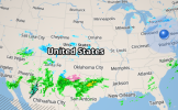
Here’s the radar shot 8 hours after the previous one above. Lots of development now.


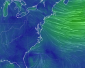
earth.nullschool.net
