I find decenter, specifically putting OWNHELO in the bottom third of the screen helps with that. I have no idea how many commercial GPS gadgets do it that way.It's funny how on smaller GPS units, TRK UP works for me, but on larger screens, not being in N UP is completely disorienting for a few moments. I blame years of ASW and SAR training.
-
Please take a moment and update your account profile. If you have an updated account profile with basic information on why you are on Air Warriors it will help other people respond to your posts. How do you update your profile you ask?
Go here:
Edit Account Details and Profile
You are using an out of date browser. It may not display this or other websites correctly.
You should upgrade or use an alternative browser.
You should upgrade or use an alternative browser.
Random Griz Aviation Musings
- Thread starter Griz882
- Start date
It's funny how on smaller GPS units, TRK UP works for me, but on larger screens, not being in N UP is completely disorienting for a few moments. I blame years of ASW and SAR training.
Same. Our flying club has a couple of people who change the G1000 to North up. It’s a pet peeve of mine.
I agree with the @IKE way. I learned land navigation long before aerial navigation so I prefer my chart/map/screen to be oriented to my route, not North Up.Same. Our flying club has a couple of people who change the G1000 to North up. It’s a pet peeve of mine.
Track Up on MFD, but North Up on Foreflight and iPad.
I declutter down 1 level and deselect terrain/topo. Airspace, traffic, and hazards are well displayed for SA this way. Terrain SA I leave for Foreflight and display minimum off route alt and maximum elevation figures along with shaded terrain.
I declutter down 1 level and deselect terrain/topo. Airspace, traffic, and hazards are well displayed for SA this way. Terrain SA I leave for Foreflight and display minimum off route alt and maximum elevation figures along with shaded terrain.
Track Up on MFD, but North Up on Foreflight and iPad.
Yep- the other piece of that is the G1000 will flip to North up while you edit your flight plan. I use that as a technique to remind me if I forgot to deactivate the cursor after an edit.
I find decenter, specifically putting OWNHELO in the bottom third of the screen helps with that. I have no idea how many commercial GPS gadgets do it that way.
I would typically do this as well unless I needed to move the symbology around to still see it with a FLIR/MTS overlay or when flying a SAR/DIP pattern. I was a huge fan of using the umbrella set to the correct wind to help with the geometry. But all of that was still N UP...probably because I'm still doing the majority of the "navigating" on the HSI.
The 530 has a page that does the same 1/3 thing, which is what I run in all the time unless I need the FPL page up when shooting an approach. If I'm remembering correctly, the 750 does the same thing. The 650 just defaults to the 1/3 plan because, well, it's a small screen.
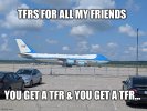
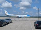
Oh, fun….so much for flying today…A little excitement outside my office this morning View attachment 43082

No TFR! No POTUS. Crew proficiency/training mission.Oh, fun….so much for flying today…
View attachment 43086
Even w/o POTUS, I've seen that thing shut down Ops in the KNHK Class D for drills. Glad it's not always a roving TFR.No TFR! No POTUS. Crew proficiency/training mission.
Almost as bad as home ops with the Blue Angles. We used to play the game of “take off before the Blues” at NPA….what a PITA.Even w/o POTUS, I've seen that thing shut down Ops in the KNHK Class D for drills. Glad it's not always a roving TFR.
I have played that game during a ferry. Had a short leg to Texas in a slick jet. Beat the Blues out of the chocks, and got cleared to climb directly to FL280… from the runway. ATC actually said “Request you expedite through 12,000, cleared for takeoff”.Almost as bad as home ops with the Blue Angles. We used to play the game of “take off before the Blues” at NPA….what a PITA.
Good times.

The other game we would play was to beat the AF CSO trainees to takeoff. We would be taxiing to the hold short, and see two AF T-6s at the hold short (assuming they were doing pitch lock & feather checks) , and we would request takeoff even before we got to the hold short to beat the slow T-6s off the runway. It's the small victories...I have played that game during a ferry. Had a short leg to Texas in a slick jet. Beat the Blues out of the chocks, and got cleared to climb directly to FL280… from the runway. ATC actually said “Request you expedite through 12,000, cleared for takeoff”.
Good times.
Overspeed governor and before takeoff checks, training command style (slowly and deliberately).(assuming they were doing pitch lock & feather checks)
Pedantic trivia warning: Pitch lock is not a thing on the T-6, and you can only feather the prop when the motor is shut down (unless the hub loses oil pressure). It’s very quick to check the system- can even be done on the roll. The airplane doesn’t “need” any time in the runup area, but it’s good training for new pilots.


